Another article about the R2AK!
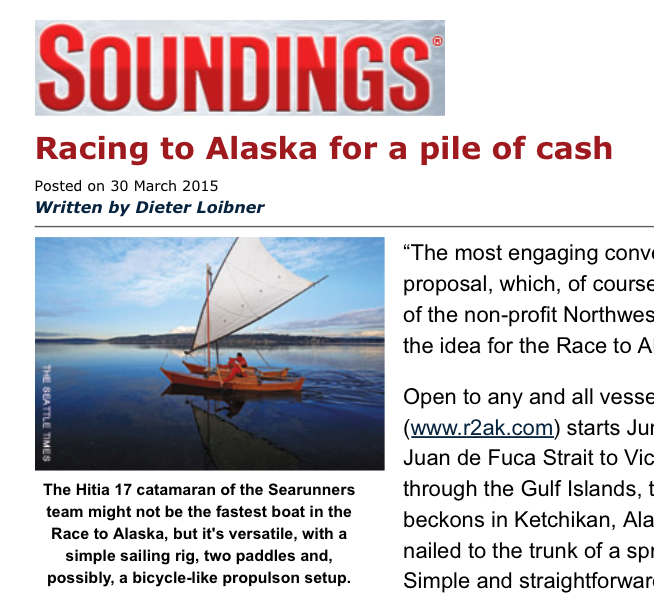
Best quote from Thomas — It’s more about the adventure.
Another article about the R2AK!
Best quote from Thomas — It’s more about the adventure.
If you haven’t listened to Jake’s introduction of the R2AK to the City of Ketchikan, hear it here….
http://www.krbd.org/2015/01/08/engineless-boat-race-with-finish-in-ketchikan/
Tough day for mariners on the northern BC coast!

What does all that red color mean? Since we’re not in the recreational boating season, it means average or mean wind speeds (not just gusts!) greater than or equal to 34 knots!
From the FAQ of Environment Canada:
Synoptic warnings include the following four categories of winds and freezing spray:
- Strong wind: Wind speed of 20 to 33 knots inclusive. Strong wind warnings are only issued for coastal or inland waters during the recreational boating season.
- Gale-force wind: Wind speed of 34 to 47 knots inclusive.
- Storm-force wind: Wind speed of 48 to 63 knots inclusive.
- Hurricane-force wind: Wind speed of 64 knots or greater.
- Freezing spray: Ice build-up rate on marine infrastructure 0.7 centimetres per hour or faster.
Note that synoptic wind warnings apply to the mean wind only. Synoptic wind warnings are not issued for wind gusts that happen to reach warning criteria.
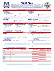
We should all fill in one of these before we leave on the R2AK race! Or any other trip on the water. How well can your friends and family describe you and your boat from memory after all. Probably not well enough. Suspecting that the Northwest Maritime Center will have their own set of information requirements on each entry. But that is just one event for a few weeks this coming June 4th.
Plans change when you sail/row/paddle small boats. The weather changes. The spot you found to camp is just too sweet to only spend one day at. Or you may be spending the next 6 hours waiting for a tide you got just a bit wrong. You ran into other like minded small boaters and do an impromptu plan change to travel together.
Those you leave behind ashore may start to wonder where you are. Sometimes having a fixed plan is just not possible or your tracker beacon stops working (been there!) or your battery dies on your iPhone or there is no signal and the Find Friends app stops sending (that happens!).
It was almost easier before all those things existed but you did need to add a widow’s walk on top of your house. Regardless, the basic info of a float plan is a good start as is a broad description of where you will be. Sometimes getting a little bit lost is exactly what your plan is. Sometimes the rescuers might benefit by narrowing down the size of the haystack. From my professional experience as a SAR vessel commander, knowing who and how many on board, size, type and description of the vessel and a general idea of where the over due party might be usually increased the chance of a happy outcome. We don’t mind searching for you even if all was well. We chock it up as training.
http://www.floatplancentral.org/